ECOLOGY
After the previous analysis, we could observe that the green spaces in Quilmes are very low in number, having a total of 2.56km2 of green spaces, which means 4.42m² per capita. The World Health Organization recommends at least 9m² of green space per person and considers an ideal of 50m². This means there is a strong need for increasing green open spaces in Quilmes.
The ecology of Quilmes is understood as the whole system of green spaces and its relations. Associated with the waters, they form the entire system of public space of the city.
The vegetation system is composed by two main areas of intervention:
-The first area of intervention is the riverside of La Plata River, from the edge of the river to the highway, the entire floodplain. This area has been deeply damaged throughout the past century. The colonization of the neighborhood of la Ribera has ignored the marshland character of the place, urbanizing a floodable area without taking appropriate measures and destroying an ecosystem of high value. There is a long stripe of protected forests that was interrupted by the construction of the new neighborhood. At the same time, the construction of the highway cuts the floodplain leaving low grounds in a risky situation for rain drainage and integration. Also, there is a vast landfill under the property of CEAMSE that spoils a large area of the floodplain, polluting the ground and modifying completely its character. Finally, a pipeline crosses the floodplain under the neighborhood of la Ribera, spoiling the ground in leak points.
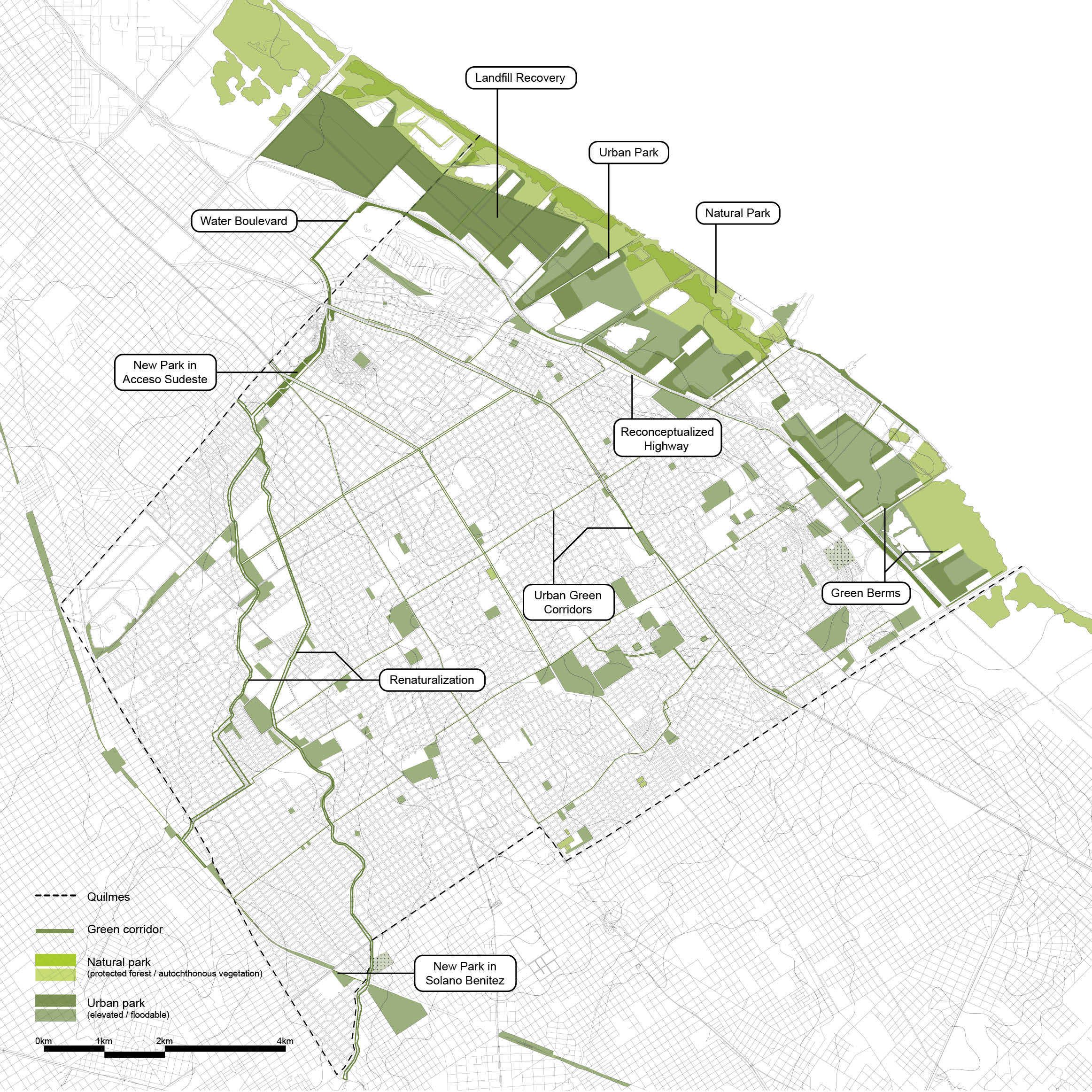
In order to fix the damaged ecosystem and in response to all the challenges mentioned above, the new vegetation system proposes two different characters for the floodplain, defining a natural park next to the riverside and an urban park next to the highway.
The natural park would be protected and responds to a territorial understanding of the place, consolidating the marshes and the autochthonous vegetation that goes from Buenos Aires to the city of La Plata.
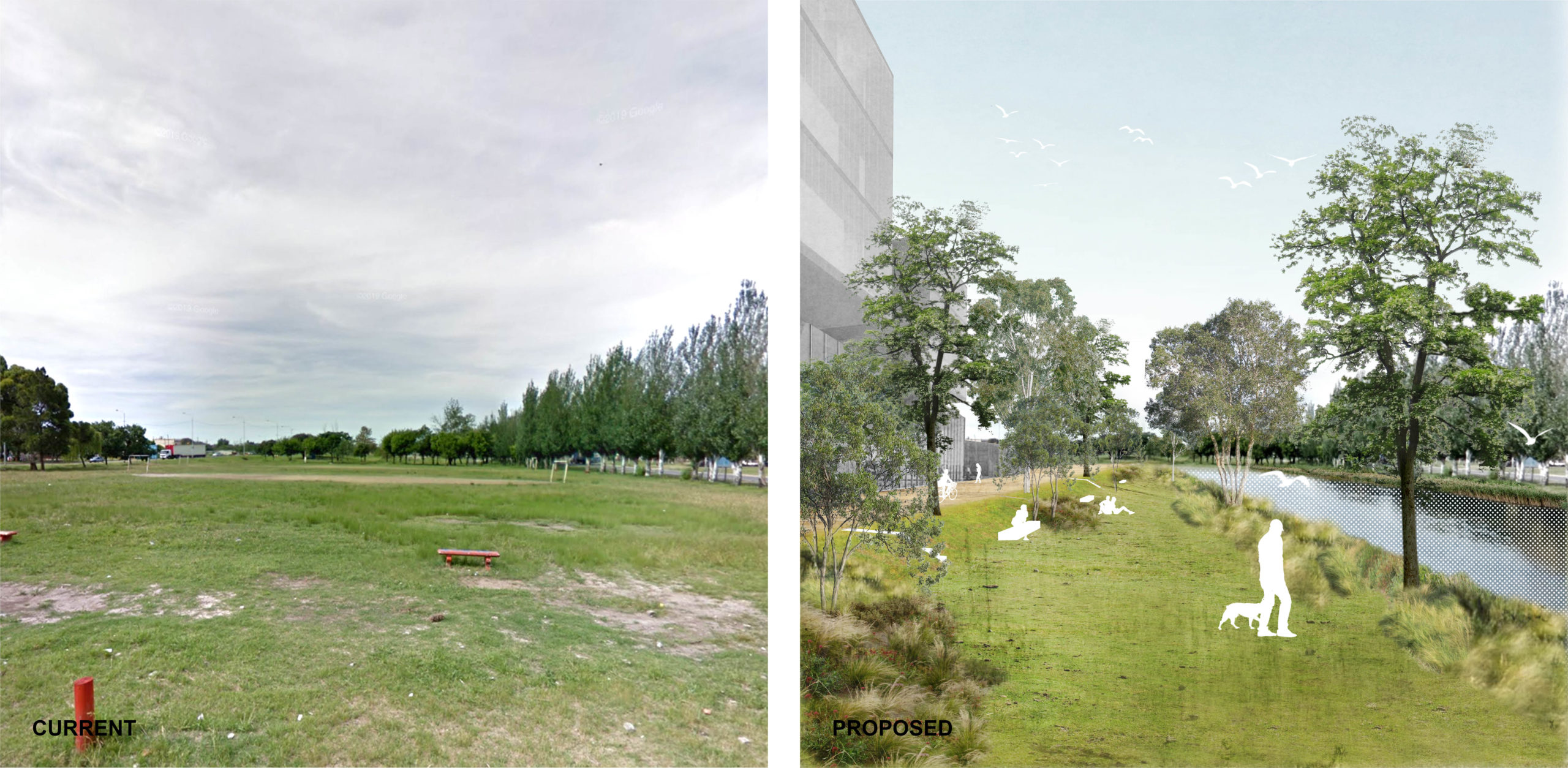
On the other hand, the urban park is related to the future developments that take place in the form of vegetated berms. These berms are built along the drainage channels coming from upstream of the highway and converted into green corridors. Both the natural and the urban park are flooded during sudestada.
-The second area of intervention is the consolidated city, south from the highway. In this area a system of green corridors weaves a green grid over the entire city. The green corridors are connected with the urban park in the riverside through the drainage channels that cross under the highway and are continuous up to the arroyos. The highway is reconceptualized and the residual spaces on its south side are converted into a linear park that widens when possible and accompanies the rainwater interceptor.
Some streets and vacant lands with great potential for helping consolidate the green grid are spotted and converted into slow mobility or pedestrian green corridors. The arroyos are renaturalized and its riverbanks are recovered as potential green corridors that have continuity with the new development in the Acceso Sudeste and the new river. The arroyos area shows many challenges regarding flood and water pollution that need to be solved. There are many vacant lots along the arroyos that could be integrated into the new system of open green spaces and could help solve flooding issues. Also, there are some villas in the riverbanks of the arroyos under high risk of flood that should be relocated with time.
VEGETATION STRATEGIES
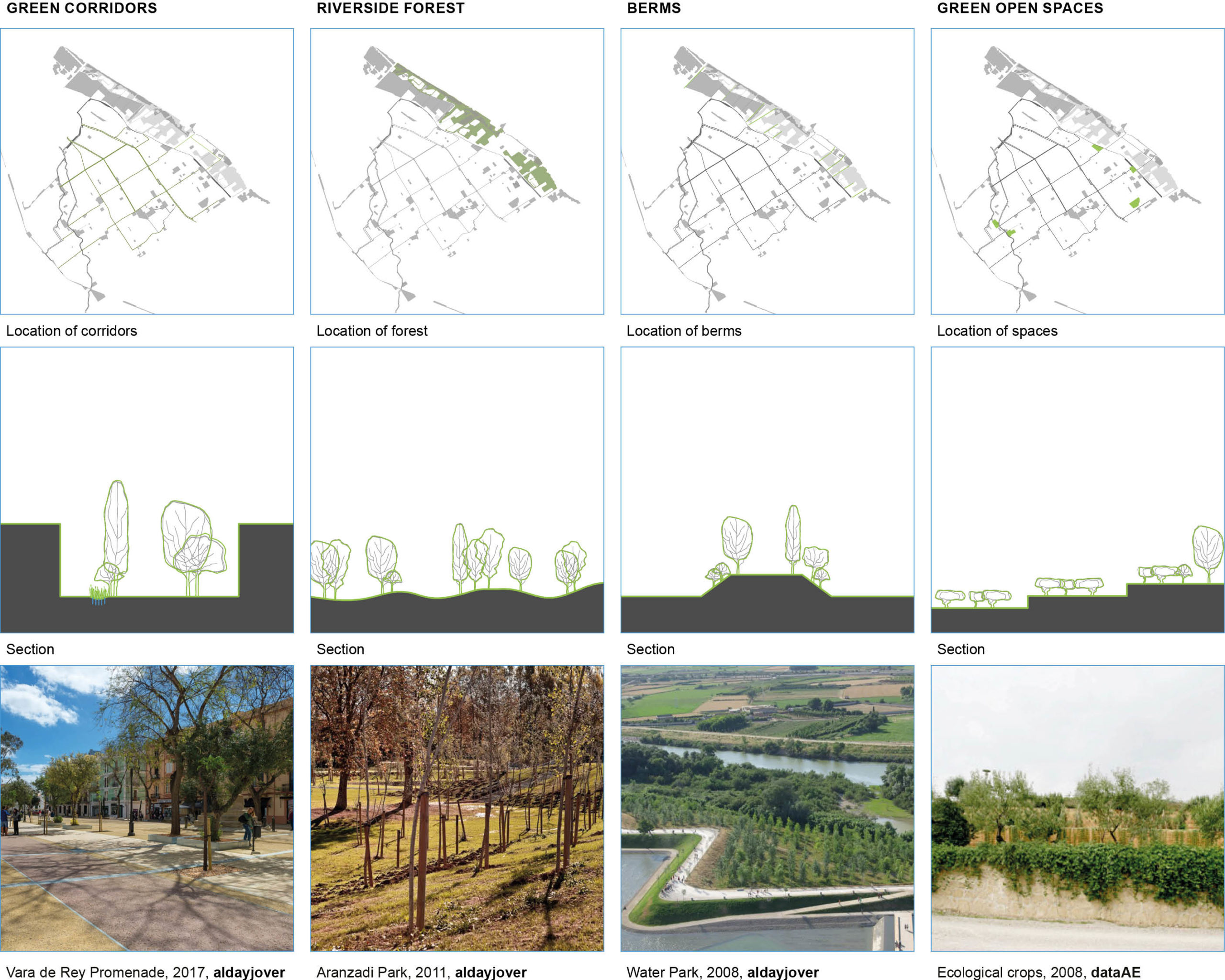
1. Green corridors: a natural grid of continuos corridors planted with local trees
2. Riverside forest: a forest in the riverside helps manage the flods and restore the natural ecosystem of the floodplain.
3. Berms: a system of green flood protections is developed in the riverside.
4. Green open spaces: a network of parks and open spaces is distributed all over the city, helping manage the topography.
WATER BOULEVARD
Avenida las Flores in Avellaneda is transformed into a water boulevard. The new river, coming from the streams and through Acceso Sudeste, flows along Av. las Flores until the highway, where it will connect with the existing streams and canals to finally take the water into La Plata River.
URBAN GREEN CORRIDORS
Various streets inside the consolidated urban grid are transformed into pedestrian or slow mobility streets. The creation of a green grid will favour activity on the streets and will also help connect the currently few and isolated green spaces in the city.
RECONCEPTUALIZED HIGHWAY
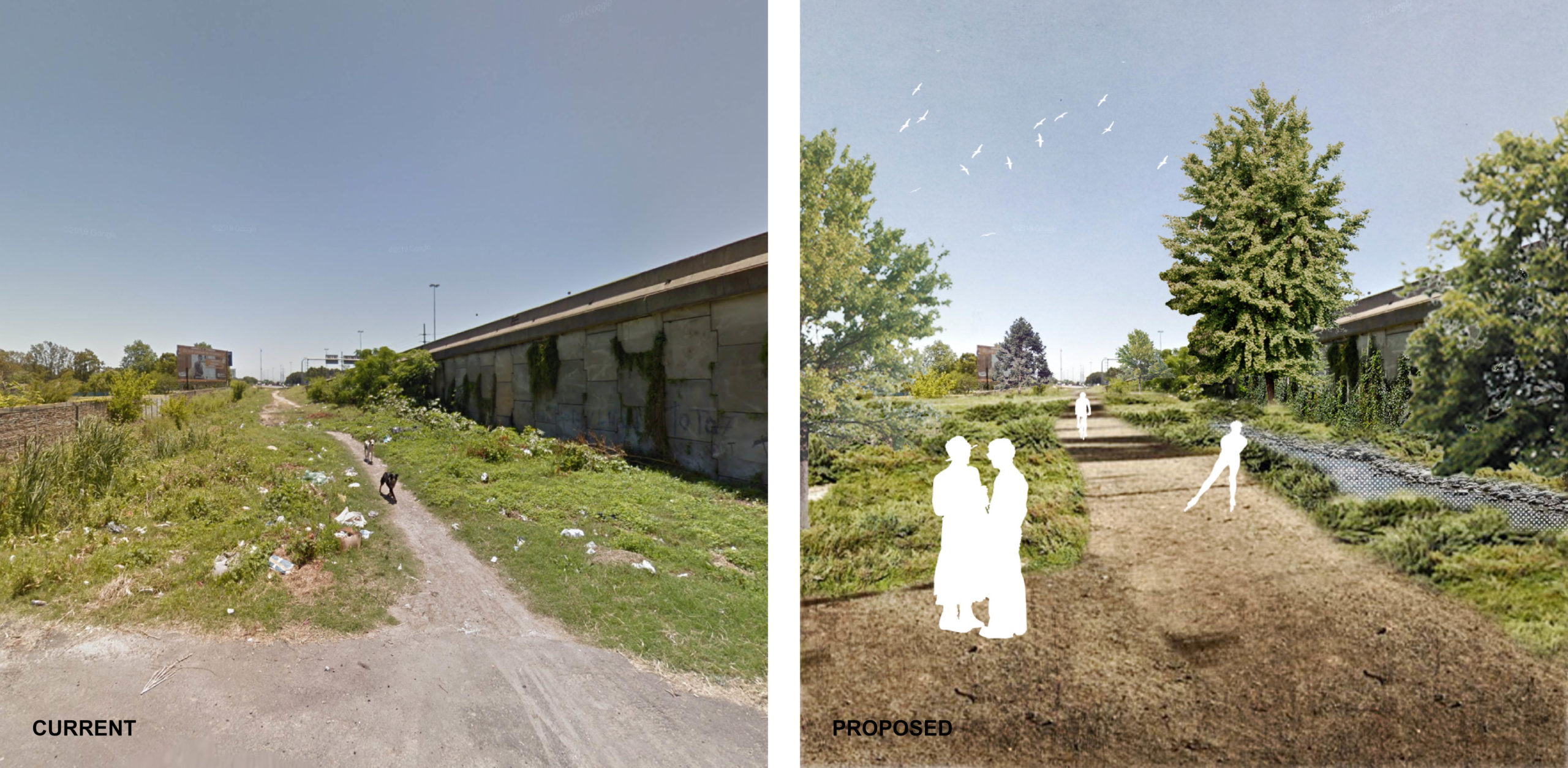
The highway divides the city from the riverside, provoking new settlements to grow next to it. The edges of the highway have currently temporary courses of water.
New green corridors with the consolidation of a continuous canal parallel to the highway and with floodable green spaces to prevent heavy rainfall undesired floods, give a new understanding of the edge of the highways as a usable new landscape.
ARROYOS
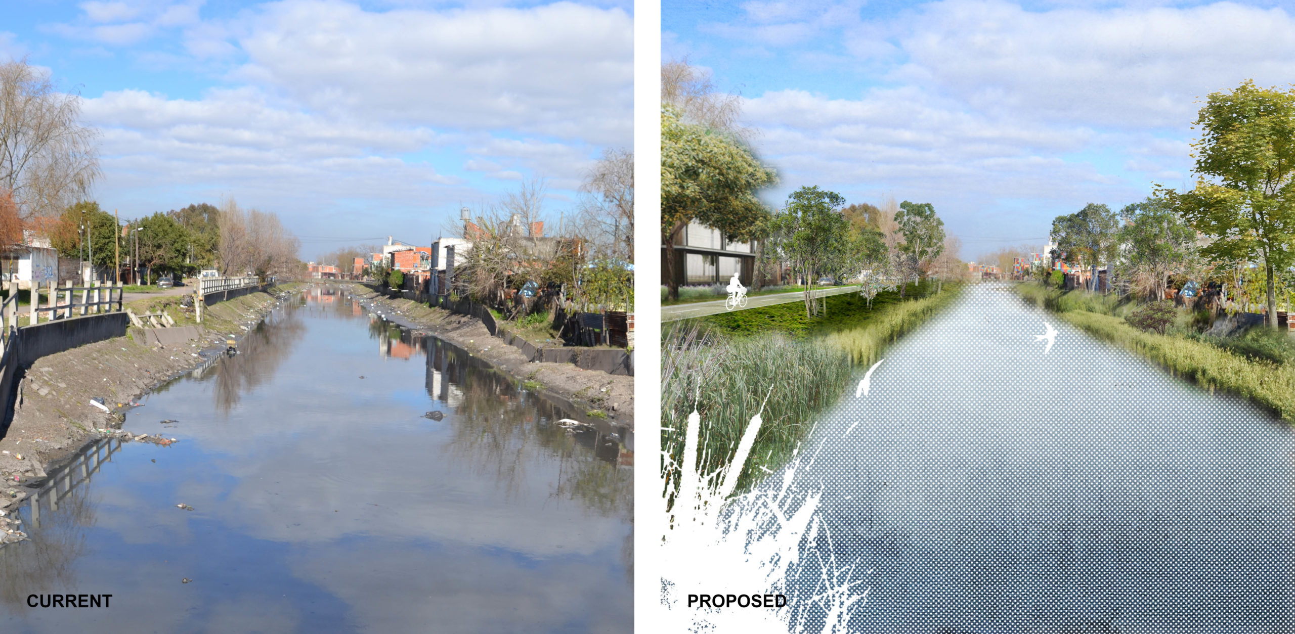
The arroyos, currently carrying sewage water and buried when entering the neighboring city of Avellaneda, are a great opportunity to reconnect the city with its waters. With softer edges and dense vegetation, the arroyos are renaturalized. A new type of green corridor is created for slow mobility by the streams.
ACCESO SUDESTE
A new river flows adapting to the built environment and taking water from the existing streams and through Acceso Sudeste down to the highway and finally to La Plata River through the existing canals.


