HISTORIC CONTEXT
Quilmes was originally a small town settled on the highest grounds of a plateau and connected with the neighboring towns by a railway that went from Buenos Aires to the city of La Plata. The limits of the plateau are defined by the floodplain of La Plata River and the two arroyos that now cross the city, creating a pronounced slope locally known as ‘La Barranca’.
HISTORIC GROWTH
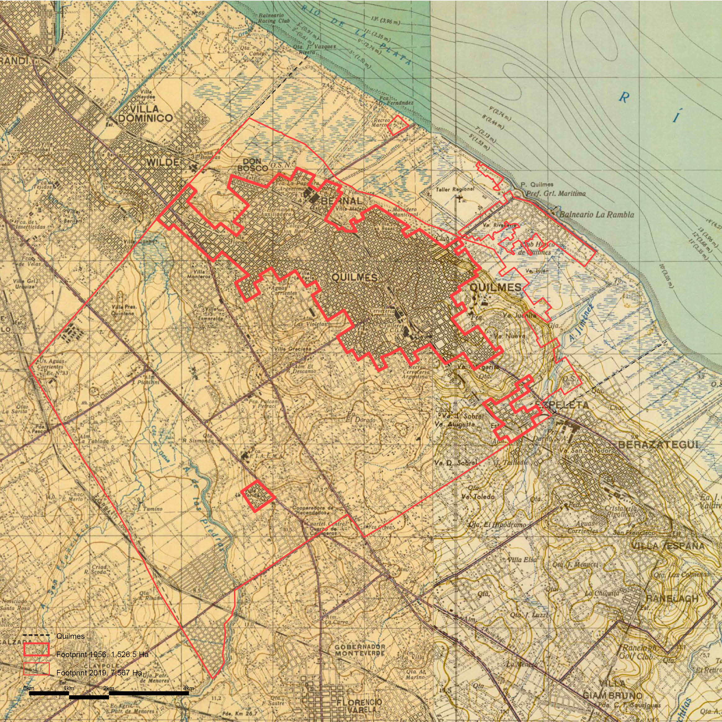
This historical map traced in the early 1910’s and updated in 1956 shows the original character of the flood plain and the urbanized area of Quilmes and the neighboring towns, located on the highest areas, between the riverside and the streams.
HYDROLOGICAL CHANGES
We can appreciate vast changes on the configuration of the marshlands and the riverbank by the overlapping of the historical map from the 1910’s with the current hydrological systems. The riverside was originally a free space for floods and marshes and is now disturbed. The colonization of the floodplain and the alterations on the ground, through excavations that served for the construction of the highway Buenos Aires – La Plata, have drastically modified the character of a large area of the riverside.


